Best Physical Maps of the United States for Home or Office
Looking for durable, easy-to-read physical maps of the United States? This guide highlights five solid choices that suit classrooms, offices, and personal study spaces. Each pick emphasizes clear labeling, durable finishes, and practical features for quick reference. The best option depends on whether you want a classic paper map, a laminated dry-erase surface, or a large poster for bold wall display. Below, you’ll find who each map is best for, why it stands out, and any limitations to consider.
| Product | Brand | Format | Best For |
|---|---|---|---|
| National Geographic: United States, The Physical Landscape (Paper) | National Geographic | Paper rolled wall map | Collectors & classrooms needing classic National Geographic style |
| Laminated United States Ranger Map Poster | South of Kings | Laminated 36” x 24” | Teachers or offices needing durable, legible labels |
| National Geographic: United States, The Physical Landscape (Laminated) | National Geographic | Glossy laminated | Dry-erase planning & settings where frequent updates help |
| 24×36 United States Executive Wall Map | Swiftmaps | Rolled poster | Large wall display in homes or classrooms |
National Geographic United States Physical Landscape — Paper

Product of National Geographic, this 31.25 x 20.5-inch wall map emphasizes the diverse geological features across the United States. It’s a refined option for offices or home study spaces, offering a classic look and strong wall presence. Best for collectors who value National Geographic’s historical map aesthetic and for situations where a traditional paper map is preferred for framing or archival display.
Who it’s best for: collectors and professionals wanting a timeless, conversation-starting map with a high-quality print for display. Why chosen: combines National Geographic credibility with a durable paper finish suitable for framing. Limitation: not laminated, so it may require framing to protect from humidity or handling.
Laminated United States Ranger Map Poster — 36” x 24”
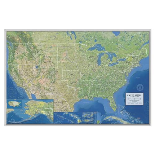
This map is laminated for durability with archival inks and a 1.7 mil satin-finish lamination on both sides. It features larger, more readable labels and insets for U.S. territories, making it ideal for classrooms or busy offices where quick reference matters. Best for teachers or planners who want a vibrant, long-lasting map with easy erase-and-update capability. Limitation: rolled shipping may require acclimation to flatten before display.
National Geographic United States — Physical Landscape (Laminated)
This laminated version from National Geographic keeps the classic look while offering a glossy surface suitable for dry-erase use. It’s best for classrooms or home offices where users want to annotate and wipe clean. Best for educators and students who want reusable boards for lessons. Limitation: laminated surface may reflect glare in bright light, which can hinder legibility from certain angles.
24×36 United States Executive Wall Map — Swiftmaps

Swiftmaps offers a larger 24×36-inch rolled poster with three-layer lamination suitable for dry-erase writing. It emphasizes legible typography and bold outlines, making it a strong option for large classrooms or home offices with expansive wall space. Best for users who want a big, reusable map with straightforward labeling. Limitation: not laminated with heavy-duty protection; handle with care to avoid creasing or edge damage.
Buying Guide
Key factors to consider when choosing a physical map of the United States include format, durability, labeling, and intended use. Below are practical questions to help match a map to your space and needs.
- What format fits my space? Paper maps look classic and are easy to frame; laminated or hinged posters offer durability and dry-erase capability for frequent updates.
- Will the map be used in a high-traffic area? Laminated surfaces resist handling and make erasing simple, which is ideal for classrooms or busy offices.
- Which level of labeling is most helpful? Maps with larger fonts and more labels improve readability from a distance and in group settings.
- Do I need archival quality versus everyday use? Archival inks and laminated finishes can last longer in display spaces, but may be more expensive.
- Is glare or lighting a concern? Glossy lamination can reflect light; matte or satin finishes reduce glare in bright rooms.
Frequently Asked Questions
- What is the difference between laminated and unlaminated maps? Laminated maps are more durable and wipeable, ideal for classrooms; unlaminated maps have a traditional, non-reflective appearance suitable for framing.
- Are large maps better for classrooms? Yes, larger formats improve visibility for groups and allow more detail to be read from a distance.
- Which map is best for collectors? National Geographic prints are often preferred for their aesthetic and historical style.
- Can these maps be hung in a home office? Yes, especially the laminated or poster-style options, which offer durability and easy updates.
- Do these maps include U.S. territories? Some editions include insets for territories; check the product features to confirm.