Best Chesapeake Bay Navigation Charts for Safe Boating and Planning
Choosing the right navigational charts for Chesapeake Bay can improve safety, route planning, and overall boating confidence. Below is a curated selection of five highly relevant charts, covering key regions from the lower bay to the eastern shores. Each entry highlights durability, readability, and practical use for anglers, recreational boaters, and professional captains alike.
| Product | Brand | Format | Notes |
|---|---|---|---|
| CBL22: Off Coastal Lower Chesapeake Bay | Captain Segull’s Sportfishing Chart | Laminated | Lower bay fishing and navigation focus |
| CBM119: Middle Chesapeake Bay | Captain Segull’s Sportfishing Chart | Laminated | Mid-bay navigation with fishing access |
| Waterproof 24 Northern Chesapeake Bay | Waterproof Charts | Two-sided, foldable | Durable synthetic paper, tear resistant |
| Chesapeake Bay Shipwreck Chart: Harve De Grace to Norfolk | Sealake Products | Paper | Shipwreck locations and coastal details |
| NOAA Chart 12270: Chesapeake Bay Eastern Bay & South River | Paradise Cay Publications | Traditional Paper | On-demand, water-resistant paper |
Captain Segull’s CBL22 Laminated Chart
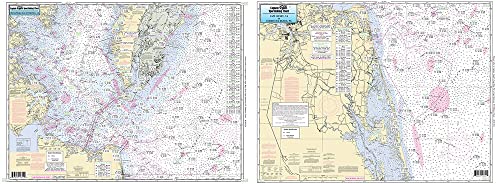
The Off Coastal Lower Chesapeake Bay chart (Chart # CBL22) from Captain Segull’s Sportfishing Charts provides a laminated, durable surface designed for fishing and coastal navigation. The laminated format protects against moisture, making it suitable for on-deck use in variable conditions. This chart highlights key inshore waters, channels, and safe anchorages, offering a practical reference for day trips and coastal excursions along the lower Bay. The laminated surface reduces wear from handling and splashes while maintaining legibility of critical navigational details.
Captain Segull’s CBM119 Laminated Chart

The Middle Chesapeake Bay chart (Chart # CBM119) from Captain Segull’s Sportfishing Charts is designed for mid-bay navigation and fishing access. The laminated format ensures durability in wet environments, while providing clear depictions of channels, shoal areas, and sheltered bays. This chart is useful for planning routes that traverse the central Chesapeake region and target productive fishing grounds, with emphasis on safe passages and recognizable shoreline features.
MAPTECH Lower Chesapeake Bay Waterproof Chart
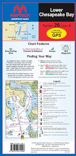
The MAPTECH Lower Chesapeake Bay Waterproof Chart, 3rd Edition, offers a rugged, waterproof option for boaters who require reliable navigational references in wet conditions. Its flip-fold design provides a large open view when unfolded (24″ x 36″), and a compact footprint when folded (6″ x 12″). The printed chart emphasizes clear imagery and legible navigational details, suitable for on-deck use and quick consultations while navigating in the lower Bay and adjacent bays.
Sealake Chesapeake Bay Shipwreck Chart (Paper)

The Chesapeake Bay Shipwreck Chart covers the Harve De Grace to Norfolk corridor in a paper format. It highlights hundreds of shipwrecks within the Chesapeake Bay, with attractive colors and pen-and-ink drawings that aid in visual recognition. This chart is a balance between navigational relevance and decorative appeal, suitable for mariners who want historical context alongside navigational cues for coastal exploration and fishing expeditions.
Paradise Cay NOAA Chart 12270: Eastern Bay & South River
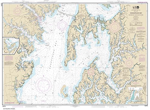
The Paradise Cay Publications NOAA Chart 12270 covers Chesapeake Bay Eastern Bay and South River, including Selby Bay, on traditional paper. The chart is printed on high-quality water-resistant paper and is produced on demand using the latest NOAA data, ensuring up-to-date navigational information. It ships rolled and is prepared for display or practical use, appealing to marshfront navigators and shore-side planners who rely on current cartography for safe passage and day-to-day operations in the Eastern Bay region.
Buying Guide: Key Purchase Considerations And Comparisons
When selecting Chesapeake Bay navigation charts, consider format, durability, coverage, readability, and update frequency. Laminated and waterproof options minimize wear in rough conditions; paper charts can offer higher detail or decorative value. Coverage should align with your typical routes—lower bay, middle bay, eastern shore, and adjacent rivers. Size and foldability affect portability and ease of use on deck or in the cockpit. For anglers and sailors alike, layered information, such as depth contours, shoal areas, and safe harbor entries, improves situational awareness.
- Format durability: Laminated versus paper. Laminated is better for wet environments; paper can offer sharper ink and larger scale.
- Geographic coverage: Ensure the chart includes your usual passages, from Harve De Grace to Norfolk, the Eastern Bay, and critical inlets around Selby Bay.
- Update frequency: NOAA-based charts should reflect the latest data. On-demand printing can provide current information for certain titles.
- Scale and readability: Larger charts (e.g., 24″ x 36″ when opened) can offer easier interpretation of depths and buoys but may be less portable.
- Supplemental features: Shipwreck overlays and decorative versus navigational emphasis should match your needs—operational planning versus wall display.
- Cost versus longevity: Laminated charts often justify higher upfront cost through extended use, while paper charts may be more economical for casual reference or teaching.
In sum, the best Chesapeake Bay navigation charts blend durable construction with precise, up-to-date information. For boaters who navigate in variable weather or spend extended time along the Bay, laminated or waterproof charts paired with traditional paper references can provide redundancy and versatility. Where decorative appeal is important, wall-worthy options can complement practical charts without compromising navigational clarity.